
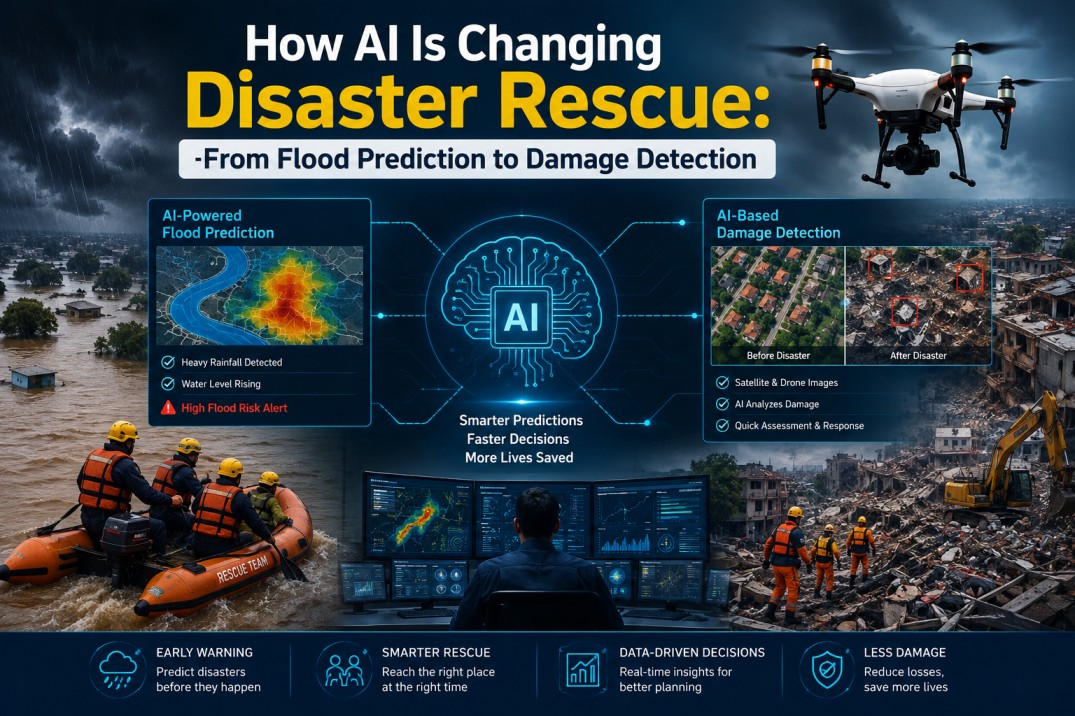
A disaster rarely arrives as a single event. A river rises, roads disappear, electricity fails, phone networks become unreliable, buildings are damaged, and suddenly the people trying to coordinate the response are working with incomplete information. The difficult question is not simply what happened? It is what is happening right now, what is likely to happen next, and where should limited resources go first?
That is where artificial intelligence is beginning to change disaster management.
AI disaster response is not about replacing rescue teams with machines or expecting an algorithm to understand a chaotic situation better than a trained human. Its real value is much more practical: AI can process enormous amounts of information faster than people can, identify patterns that are difficult to see manually, and turn scattered data into predictions or maps that responders can act upon.
But there is an equally important side to the story. AI can be wrong. It can work brilliantly in one geography and poorly in another. It can struggle when sensors fail, imagery is blocked by clouds, or an unusual disaster behaves differently from anything in its training data.
The future of AI disaster management, therefore, may not belong to systems that make every decision themselves. It may belong to systems that help humans make better decisions earlier.
The First Shift: From Responding to Anticipating
Traditional disaster response often begins after the danger becomes visible. A river crosses its danger level, a road is submerged, a building collapses, or residents start calling for help.
AI changes the timeline.
Instead of asking only, “Where is the disaster?”, machine learning disaster management systems can ask, “Based on everything we know, where is the disaster likely to move next?”
This distinction matters enormously during floods.
An AI model can combine rainfall forecasts, historical river behaviour, terrain, elevation, soil conditions, river-gauge readings and satellite information to estimate how water levels may change. More advanced systems can then estimate which parts of a floodplain could be affected.
The output is not necessarily a dramatic prediction such as “this neighbourhood will be destroyed.” It may be something much more useful: a map showing increasing flood probability, expected water levels, or areas that may require preparation.
Google’s Flood Hub, for example, uses AI-based hydrological and inundation models to provide river-flood forecasts several days ahead in many parts of the world. More recently, AI has also been used to build historical datasets for urban flash floods, where conventional sensor data is often scarce.
That creates an important possibility: the most valuable moment for AI may be before the rescue begins.
What AI flood prediction can actually change
Suppose a district expects severe flooding in three days.
Without useful forecasting, authorities may wait until water levels become dangerous before moving people, vehicles and supplies.
With a sufficiently reliable forecast, they can begin earlier:
- Move emergency equipment to safer but accessible locations.
- Pre-position food, medicine and rescue boats.
- Identify roads likely to become unusable.
- Warn vulnerable communities.
- Protect important infrastructure where possible.
- Decide which evacuation routes should be prioritised.
- Prepare shelters before thousands of people arrive.
The prediction itself does not rescue anyone. The decision made because of the prediction does.
That distinction is easy to miss when talking about AI and disasters.
AI Does Not “See” a Disaster. It Reconstructs One From Data.
One of the most interesting developments in AI disaster response is happening above the disaster zone.
Satellites, drones, aircraft and ground sensors can produce enormous amounts of information during and after an emergency. The problem is that raw imagery is not automatically useful to a rescue coordinator.
A satellite image may show hundreds of square kilometres. A responder needs to know which roads are blocked, which bridges are damaged, which buildings appear destroyed and which communities have become isolated.
This is where computer vision becomes valuable.
AI systems can compare imagery captured before and after an event and identify changes across the landscape. A damaged roof, a collapsed structure, a flooded road or a newly formed debris field may be flagged automatically for further investigation.
This is the foundation of AI damage detection.
Imagine a city hit by a major cyclone. Before the storm, authorities have detailed aerial or satellite imagery. After the storm, another image is captured.
A human team could manually examine the two datasets.
An AI system can perform the first pass across thousands of structures and highlight areas where significant changes appear to have occurred.
The difference is not merely speed. It changes how people work.
Instead of asking dozens of analysts to search for everything, authorities can give human experts a prioritised list of places that deserve attention.
From “What is damaged?” to “What should we inspect first?”
This is one of the more useful ways to think about AI damage detection.
AI does not necessarily need to determine with absolute certainty that a building is unsafe. In many situations, it is more useful if the system can identify:
“These 300 locations have characteristics consistent with severe damage. Inspect these first.”
That turns AI into a filtering system.
Recent research has demonstrated this potential using drone imagery collected after disasters. AI models have been tested in real response environments to assess building damage rapidly, demonstrating how aerial imagery can be converted into actionable information much faster than traditional manual assessment.
For emergency managers, that can mean hours saved.
And during a disaster, hours can matter.
The Rescue Map Is Becoming a Living Map
There is another important change taking place.
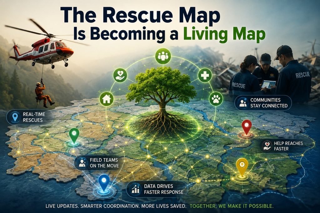
Historically, disaster maps were often treated as relatively static products: a map of evacuation zones, roads, shelters, hospitals and hazard areas.
AI makes it possible to think of the disaster map differently.
It can become a living information layer that changes as new data arrives.
Consider a flood moving through a city.
At 8 a.m., a road may be open.
At 10 a.m., satellite or drone imagery, traffic information and field reports may indicate that it is flooded.
At noon, another route may become inaccessible.
An AI-assisted system could continuously update the operational picture and help responders understand which routes, facilities and communities are becoming increasingly difficult to reach.
The same principle can apply to wildfires, landslides, earthquakes, cyclones and other emergencies.
A simplified AI disaster-response chain
Data → Detection → Prediction → Prioritisation → Human decision → Action
Each stage has a different role.
| Stage | What AI can help with | Human role |
| Data | Combine weather, imagery, sensors and reports | Decide which sources are trustworthy |
| Detection | Identify possible flooding, damage or blocked routes | Verify important findings |
| Prediction | Estimate what may happen next | Judge uncertainty and consequences |
| Prioritisation | Rank areas requiring attention | Decide operational priorities |
| Decision | Present scenarios and recommendations | Authorise and coordinate action |
| Action | Track changing conditions | Rescue, evacuate and assist people |
The table reveals something important: AI is strongest in the information-heavy middle of the disaster-response chain.
It is much weaker when the problem requires physical intervention, local judgement, negotiation or moral responsibility.
Where AI Still Struggles
This is the part that gets lost in many discussions about AI disaster management.
An AI model can produce an impressive map and still be wrong.
A flood prediction can underestimate rainfall. A satellite image can be obscured by clouds. A damaged building can look intact from above while suffering dangerous internal structural failure. A road may appear passable in imagery but be unusable because of debris or live electrical wires.
There is also the problem of unusual events.
Machine learning learns patterns from data. But disasters have a habit of producing situations that do not fit historical patterns.
A model trained on ordinary river floods may struggle with an unprecedented combination of extreme rainfall, dam failure and landslides. A damage-detection model trained on one country’s building styles may perform differently when applied to another region with completely different construction materials.
The biggest limitations are often not the algorithm
AI performance depends heavily on the quality and availability of data.
A sophisticated model cannot magically manufacture accurate ground truth where none exists.
This creates a paradox. The places that could benefit most from advanced disaster technology may also be the places with fewer sensors, weaker connectivity, limited historical datasets and less frequently updated maps.
That is why one of the most interesting directions in AI disaster response is not simply building larger models. It is finding ways to make useful predictions from imperfect and incomplete information.
AI Can Also Help With the Problem of Too Much Information
During a major disaster, information can become almost as overwhelming as the physical event.
Emergency centres may receive satellite imagery, weather updates, drone footage, social media posts, phone reports, field-team observations, sensor readings and government communications simultaneously.
The challenge becomes information triage.
AI can help classify incoming reports, identify duplicate information, extract locations from text, detect recurring patterns and surface potentially important changes.
For example, hundreds of residents may report that they cannot cross a particular road. Individually, those messages may be difficult to process. Collectively, they could indicate a developing transport bottleneck.
AI can help convert those scattered reports into a structured operational signal.
But again, a signal is not the same thing as truth.
A social media post can be outdated. Multiple posts may simply repeat the same original rumour. A location may be incorrectly identified.
Human verification remains essential when decisions carry serious consequences.
The Real Advantage: Buying Time
Perhaps the most useful way to measure AI in disaster management is not by asking whether it can replace a human responder.
Ask instead:
How much useful time can it give the people who have to make the decision?
An extra six hours before flooding can mean supplies are moved before roads disappear.
An automated damage assessment that takes minutes instead of days can help engineers decide where to inspect first.
A constantly updated map can help a rescue coordinator redirect teams before a route becomes inaccessible.
A system that analyses thousands of incoming reports can help an emergency centre notice a developing problem before it becomes obvious from a single source.
In disasters, time is not an abstract metric. It changes the number of choices available.
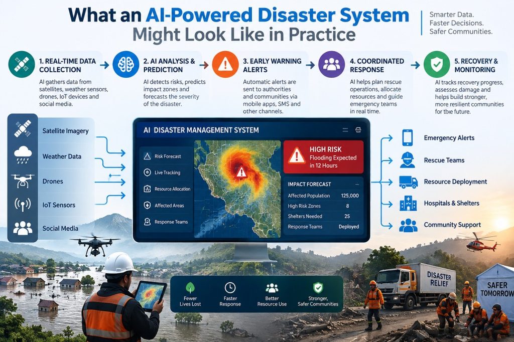
What an AI-Powered Disaster System Might Look Like in Practice
Imagine a severe cyclone approaching a coastal city.
72 hours before landfall
AI models analyse weather patterns and estimate areas facing the greatest risk. Authorities begin reviewing evacuation plans and identifying vulnerable communities.
24 hours before landfall
Updated forecasts refine expected rainfall, wind and flooding. Emergency teams move equipment closer to priority zones while keeping it outside the projected danger area.
During the storm
Real-time information becomes fragmented. Sensors, field reports and available imagery are combined to maintain an evolving picture of affected areas.
Immediately after
Satellite and drone imagery are analysed for damage. AI identifies possible road blockages, heavily affected structures and areas showing significant changes.
Rescue phase
Responders use the information to prioritise locations for physical inspection and assistance.
Recovery
Repeated imagery and data can help authorities track rebuilding, infrastructure damage and changes in affected communities.
Notice what is missing from this scenario: an AI robot taking over the rescue operation.
The technology is working more like an enormous information-processing layer around human teams.
That may actually be the more realistic future.
The Cost Question: Is AI Worth It?
AI disaster technology can sound expensive, but the economics need to be considered differently.
The biggest cost is not always the AI model itself. It can involve satellites, sensors, communications infrastructure, high-quality mapping, data storage, trained personnel and the systems required to integrate all of them.
For smaller administrations, building everything from scratch may be unrealistic.
A better approach can be to combine existing public datasets, open geospatial information, satellite imagery, government systems and cloud-based AI services rather than attempting to create an entirely independent technological ecosystem.
The goal should not be “use AI everywhere.”
It should be:
“Use AI where processing information faster produces a meaningful operational advantage.”
That might be flood forecasting in one region, wildfire mapping in another and post-earthquake damage assessment somewhere else.
The Human-in-the-Loop Is Not a Weakness
There is a temptation to view human intervention as evidence that an AI system is incomplete.
In disaster management, the opposite is often true.
A good system should know where its confidence ends.
AI can say that an area has a high probability of flooding. A hydrologist can interpret whether that forecast makes sense given local river behaviour.
AI can flag a collapsed building. An engineer can determine whether entering it is safe.
AI can suggest an evacuation route. Local authorities may know that the route regularly becomes blocked or that residents cannot realistically use it.
AI can process the evidence.
Humans understand the consequences.
That combination is much more powerful than either side working alone.
What Comes Next?
The next generation of AI disaster management will probably be less about spectacular predictions and more about connecting previously disconnected pieces of information.
Weather forecasts could feed flood models. Flood models could feed evacuation planning. Satellite imagery could feed damage detection. Drone imagery could refine those assessments. Field teams could verify the most uncertain locations. Every verified observation could then improve the information available for the next decision.
That creates a feedback loop:
Predict → Observe → Verify → Update → Act.
The technology becomes valuable not because it claims to know everything, but because it gets better at helping people understand a rapidly changing situation.
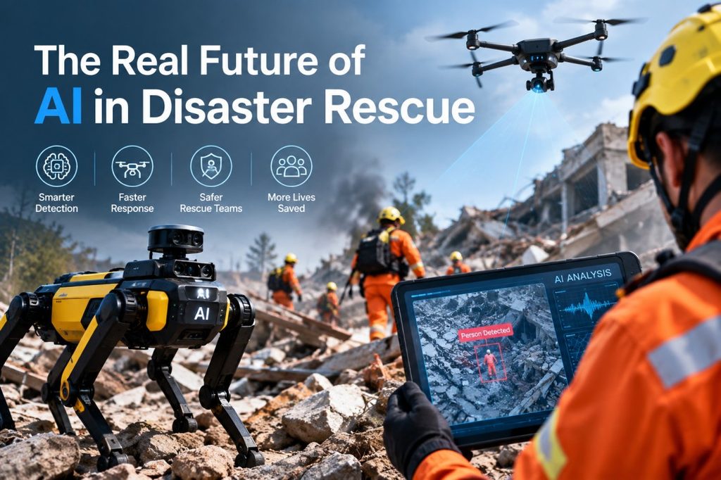
The Real Future of AI in Disaster Rescue
AI will not stop a river from rising, hold up a collapsing building or carry an injured person out of a flooded neighbourhood.
Its contribution is different.
It can help emergency teams see the threat earlier, search enormous datasets faster, identify damage across huge areas, estimate what may happen next and decide where human attention is most urgently required.
That is why the most useful question is not whether AI will replace humans in disaster rescue.
It is whether a rescue team equipped with better predictions, better maps and faster information can outperform the same team working without them.
Increasingly, the answer appears to be yes.
But the winning model will not be AI versus humans. It will be AI handling the scale and speed of information while humans handle judgement, responsibility and action.
In a disaster, that division of labour could be one of the most important technologies of all.